Stuck on Annapurna
04Jan
2014
2014
Trekking around Manaslu took us only 11 days. We ended march in the village Dharapani – located on the trail leading around the Annapurna massif – much earlier than we had initially planned. Remaining question: What to do next? We could stay in Nepal for some more time, and spend at least one week more in the mountains. We had also yet unused permits – retained after trekking around Dhaulagiri (we just had to do light, almost imperceptible modification of the dates on the TIMS cards and enrich our itinerary with the Marpha–Beshisahar episode). There were also good reasons against staying. We did not want to continue trekking around the oh-so-popular Annapurna. Our reserves of stamina were almost empty after an exhausting “run” through the Manaslu Conservation Area. And the most important – we had no money with ourselfs, because we gave last rupees to our guide in Samdo… We were able to obtain more money pretty easily (by taking a shared jeep to the nearest ATM in the Besisahar and returning to Dharapani the same day). Therefore, we rejected all the other reasons against going… And that’s how we ended up on the most popular trail in Nepal – Annapurna Circuit.
We did not expect too much from the trekking. we treated the route with a wink, and called days spent on the Annapurna “the rest ones”. Maybe just after a few all-camping, cold and really exhausting treks we lost a point of reference? Perspective of guesthouses with warm shower, eat, which we did not have to carry on our back (Ha. Not really, as we have added a few pounds by habit, just in cause) and simple as a wire trail seemed to us truly idyllic… And that was what we needed!
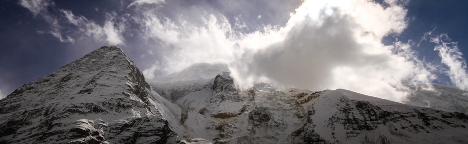
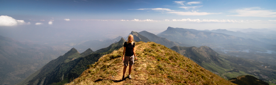
How was it? Annapurna surprised us positively. Very positively. We expected crowds, touts, tourists, kitsch. We found end-of-season emptiness, silence and space. In mid-December, most guesthouses were already closed for the winter, and on the trail we met relatively few people (but really interesting). We were accompanied by the paramount views and very stable, sunny weather. And although it was getting colder by every day, we strongly recommend to go there just after season!
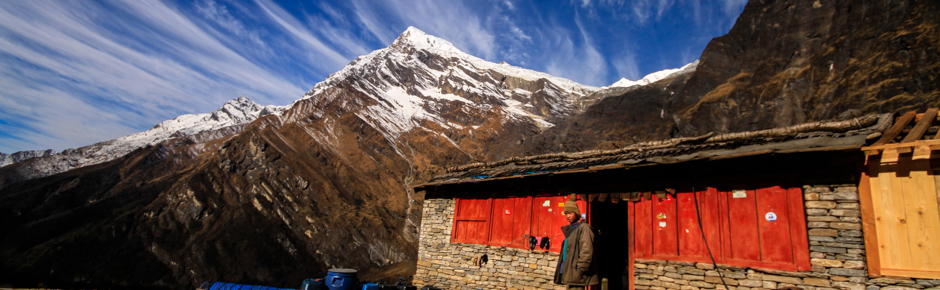
In the villages we passed on the way there are many small shops, tea houses and local eateries. Everywhere you can buy: instant noodels, tuna in a can, cookies and other sweets, and in many places also selroti bread baked with semolina. In Chame, the largest village on the trail, you can buy almost anything, and the offered product range is much greater than in Besisahar.
There is no ATM on the entire route, the last one is in Besisahar. In case of emergency we can use cash advance service at the bank in Chame (with hefty commission – 10%) or in the Hotel Yeti in Manang (even higher fees). In Jomson there should be a bank and apparently even working ATM (we weren’t looking for it).
Gas cartridges and fuel for petrol stoves can be obtained in Besisahar and several other villages on the trail along the way (eg. in Manang you can buy cartridges and kerosene).
Annapurna belongs to the arid regions, there is water shortage on the trail (it is only available in the villages and several streams crossing route), so you should always have an emergency supply of it – at least a liter – with you. On the way you can use the safe drinking water stations (40-50 NPR for 1 liter), however the majority of them was already closed in December. We drank untreated water, but we do not encourage anyone to take example from us. Better to have water purification tablet, a mechanical filter or SteriPEN.
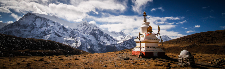
How to plan a trekking, day by day? The possibilities and options are many. Along the way, you can take a few side trips into the surrounding valleys: to the PisangPeak Base Camp or Tilichio Lake. We opted for a shorter 7-day variant. We especially recommend side trail to the Ice Lake – hence the good weather we will see the best panorama of the surrounding mountains, including the entire range of Annapurna. Detailed information about the route planning can be found in many places on the internet. We can definitely recommend this description:http://www.nepal-dia.de/Nepal_Reisebericht_Annapurnaru/Trekking_the_Annapurna_Circuit_with_the_new_NATT_trails_111017.pdf