Quite spontaneously we went on another trek – this time in the Gahrwal Himalayas, located in the state of Uttarakhand, north-east of Delhi. We made Rishikesh our base for a couple of days. Since we did not have a detailed plan, it took us a few days to prepare for the trek. We couldn’t decide for long, exactly where to go and what route we want to take. Eventually we decided basing on a quick and direct access from Rishikesh to starting point and uncomplicated return.
The choice fell on the region of Khatling and Phatling glaciers – partially described in the popular Lonely Planet guide. We decided to continue the Shipton and Tilman’s route, who in 1934 conducted a technically difficult traverse across mountains between the three holy places of worship: Gangotri, Badrinath and Kedarnath. Our goal was to get from the village Guttu via five-thousand Mayali Pass to Kedarnath and then to Gaurikund.
Since the trek was supposed to be ‘easy’, and we had only two high passes to cross, we did not prepare really well. (After all, trekking described in the LP cannot be difficult!) And in this way – with full backpacks, only the general scheme of the route and the description of the LP guide in hand – we went to the mountains…
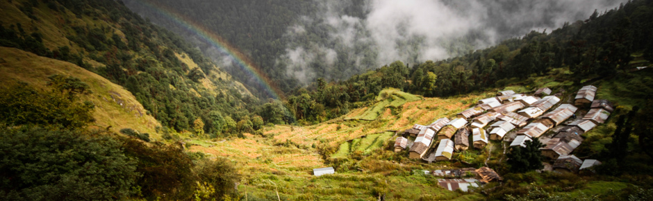
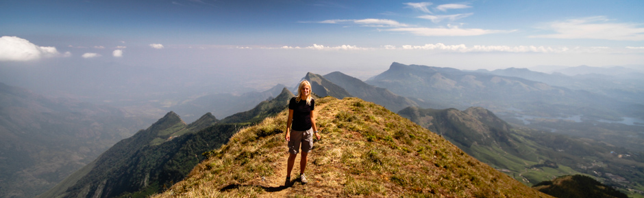
Trekking turned out to be a real challenge. We were surprised simultaneously by physically challenging and difficult to find route, numerous landslides, as well as comprehensive, steep – and endless – ascends. In the mountains it rained almost every day, and every day just before noon the sky was filled with thick clouds – depriving us of visibility. In rhododendron forests there were many wild animals – white monkeys, snow leopards and bears! A description in our guidebook was – WARNING – totally incompatible with the reality and in fact completely useless! Nevertheless, we were able to complete the intended plan and go from Guttu to Gaurikund (and eventually even further, to the next village – Sonprayag) in nine days.
We recommend this route only for experienced trekkers. Below, a handful of practical information, detailed description and a map – everything you need to go trekking “in our footsteps”.
Practical info
Getting there and back from the trek is easy. There is a daily bus to Guttu from Rishikesh (Yatra Bus Station) at 3.15 am (ticket 250 INR / person). You can also take a bus to Gaurikund at 3.45 am and change there for Guttu (ticket to Gaurikund 170 INR / person + ticket to Guttu 40 INR / person.) Journey takes about 8 hours. When going back you can catch a bus to Rishikesh in Sonprayag (running road once led to Gaurikund, but the river took it), the first at 6:30 am, the next at 7.00 am. The journey takes about 10 hours.
Trekking season in this part of the Himalayas runs from May to June (when the rhododendrons bloom) and from September to the end of October. Regardless of the season, the weather is usually not good – bring your umbrella (the most rainy mountains we’ve ever managed to visit).
A schematic map of the region (color brochure) can be obtained in Uttarakhand Tourist Office in Delhi (Connaught Place – Suite 102, Indraprakash Bldg, 21 Barakhamba Road). A similar scheme is also available on the GMVN site (here). Central Tourist Office is located in Dehradun, as the local mountain club – Nehru Mountaineering Institute (database of information on trekking in Garhwal). A better map of the area you can be obtained at the offices of the government organization Survey of India (www.surveyofindia.gov.in) or bought in a bookstore before leaving the Europe.
When choosing this trek it is well worth seeking out up to date information and photos at least from a few different sources, and treat a description in the Lonely Planet with some reserve (it seems to us that the author had never been there, but only relied on the descriptions of local guides). This route is dynamically changing, new landslides arrives, and perhaps in the next season also our description will be obsolete.
In the autumn season – in our opinion – there is no need to take climbing gear. However, in May, when there is usually still a lot of snow in the passes, crampons and ice axe might be useful.
In Kedarnath we learned that trekking across the Masar Tal and Vasuki Tal lakes requires a special permit, although we were unable to confirm this information in the Internet. Policemen stationed at the camp – within the discretion of our achievement (very hard, very dangerous) – let us that time without complications. The best place to ask about the permit is the government trekking agency – GMVN (www.gmvnl.com) in Delhi, Rishikesh, Haridwar or Dehradun.
We didn’t find gas cartridges anywhere in the Rishikesh. Although, there is a gas station where You can get petrol without any problem.
This route is seldom visited and the trail is not equipped with any tourist facilities (Tourist Rest Houses in Reeh and Gangi are neglected hovels), so you need to bring your own food and necessary camping equipment. While trekking we met only local shepherds. People living in the valley knows only the language of Urdu, so you cannot communicate in English there. In addition, in every village along the way people asked us – doing the sweeping gestures – for something to eat, so you probably cannot get anything for eating there…
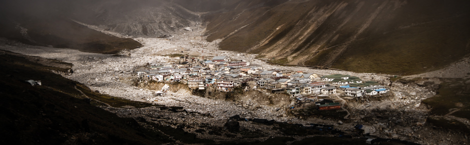
Before heading out for trekking it is worth checking what is the current situation in flooded in June 2013 valley of the river Mandakini. Villages, located in the valley were completely destroyed during the flood (more information can be found in our photo story “Flood in Kedarnath – the first such tragedy in India”). You won’t find shops or hostels there, even Kedarnath – the most popular place of pilgrimage in Garhwal – is now deserted. The pilgrimage road is gone, and a new path – led the opposite site of the valley – is under construction. Currently on trail Gaurikhund – Kedartnath government camps available for pilgrims are placed. In the three of them: Ketharnath, Rumbaka and 6 km up the valley from Gaurikund it’s free to spend the night and eat thali– but it is unclear how long the police will be stationed there.
Detalied route description
Our route led up the Bhilan Ganga river, via Mayali Pass into the valley of the river Mandakini. We started trekking from a small town Guttu, visiting along the way a number of smaller villages – Reeh, Gangi and Deordi. After a few days we got to the Khatling glacier, from where we went into side valley and – through the mountains, past lakes Masar Tal and Vasuki Tal – went down to Kedarnath, Gaurikund, Sonprayag.
Day 1 Guttu - Reeh
10.5km, 4h 30min, 780m elevation gain
We start from a height of 1537m. From Parking in Guttu (bus stop) we follow the gravel road – immediately left, bypassing the village. We’re on true right of the Bhilan Ganga river, ascending a gentle uphill traverse. After about 4 hours we reach the village Reeh (2060 m). This section has about 10.5 kilometers. There is GMVN Tourist Rest House in the village – the only comfortable camping place in the area (bed in the dormitory – 100 INR / person; tent – 150 INR). The lodge is currently in very poor condition and often – even in peak season – just closed.
Day 2 Reeh - Gangi
9.75km, 5h, 800m elevation gain
We leave Reeh by a clear shepherd path, cross the bridge on the tributary and begin to ascend zigzags, traversing the vast ridge. After about 3 hours we reach the village Nerlan (2600 m), and after another 2 hours to Gangi (2650 m) – the biggest village located in the valley. Right above it, there is another Tourist Rest House (during our stay – closed) – a good place for camping.
Day 3 Gangi - Kharsoli
12km, 6h, 1000m elevation gain
From Gangi we go by a gentle traverse, gradually going down to the bottom of the valley. After about 1h 15min we cross sidestream (concrete bridge) and reach the level of the main river. On the way we pass the small village Deordi (2440 m). After it we traverse the mud landslides and cross another side stream (concrete bridge). Then we climb steeply uphill and after about 1 hour drive from the village, we reach the Kalyani meadows (2640 m). (At this point, the trail forks apparently, the upper one going to Sahashtra Tal lake – but we could not find it.) We pass the meadows and climb further up the hill by clear, trodden by animals path. After about 1 hour we reach one of the major tributaries of the Bhilan Ganga river (crossing can be difficult). We continue walking along the bank of the river, bypassing the bottom, broken pieces of the path. After about 2 hours we reach the Kharsoli meadows at an altitude of 2896 m (comfortable camping place).
Day 4 Kharsoli - Khatling Cave
14km, 7h, 1500m elevation gain
From Kharsoli meadows we go up the main valley and after about 1.5km, we cross the tributary of Bhilan Ganga (in a small clearing there is a small Hindu temple and shepherd’s hut). Then we go down to the main river and use our senses to find the route further up the valley – using parts of the old path on the side and diverse the landslides on the bottom of the valley. The trail starts to climb steeply. At an altitude of about 3200 m we leave the forest to scree slopes and cross another side stream. We’re going in the direction of – visible in the distance – alpine meadows, past the remains of shepherd’s camps. After about 2 hours 30 minutes from the exit from the forest we reach the Khatling Cave (3680 m) – a covered area, ideal for camping for 1-2 tents. Looking at the opposite side valley we can see our further route to the lake Masar Tal and then to Kedarnath. Less than 5 minutes away from the cave, there is another good but not roofed camping.
Day 5 Khatling Cave - Chobi
11km, 8h 1300m elevation gain
From camping place we descend steeply to the valley bottom. That brings us to the vast moraine, which we follow further up the valley using indistinct path. After about 1.8km we reach the place where the stream flowing from the glacier Phatling connects to the main river. It is one of the best places to cross to the other side of Bhilan Ganga riverto the next bivouac site Chobi. The crossing is much safer in the morning, when there flows much less water than in the afternoon (glacier river!). After crossing the main river climb without any route to the visible moraine of Phatling glacier to the lake and the camping place Chobi (or Chowki – 3703m).
Instead of immediately crossing to the other side, we can continue (without backpacks) march to the so-called Zero Point (3911m in 2013) – the place where Bhilan Ganga flows from the Khatling glacier. If we want to do so, we remain on the true right bank of the river and continue to march without a path about 4km up the valley. Return the same way – the whole trip takes about 3 -4h . If high water prevented us from crossing of the river, we can bivouac and cross to the other side the next day in the morning.
Day 6 Chobi - Masar Tal
11km, 9h, 1600m elevation gain
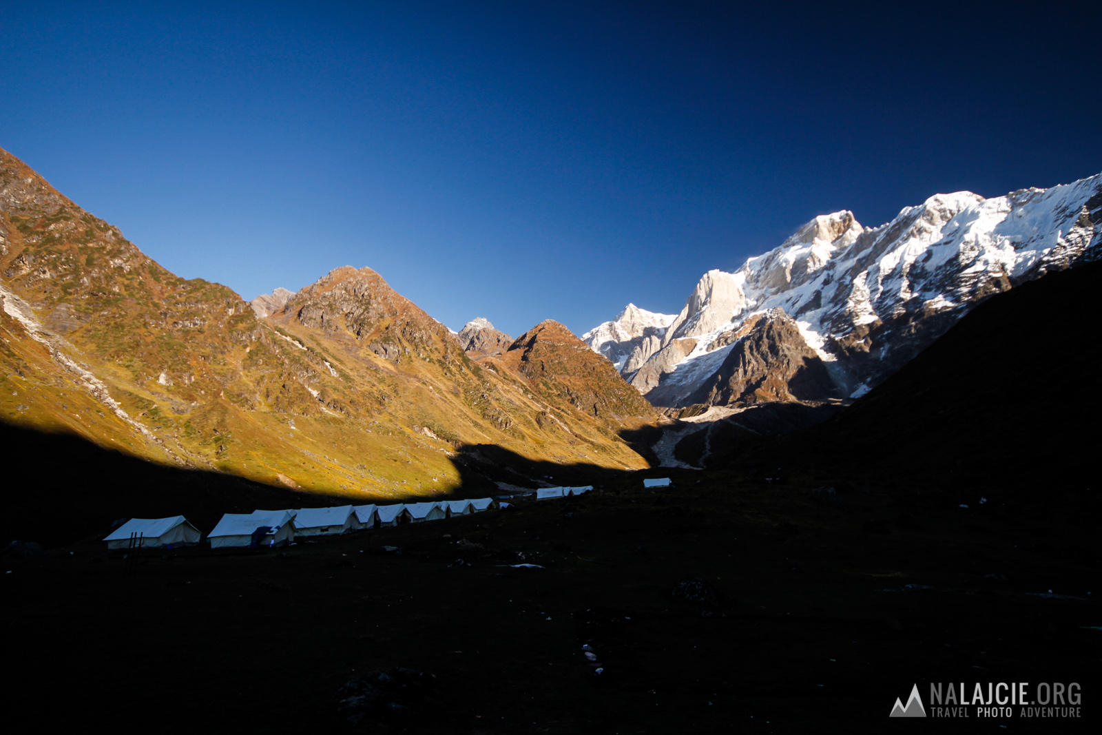
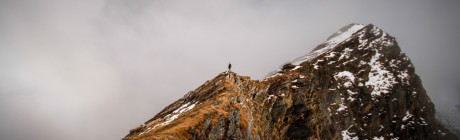
From Chobi campsite we slightly descend to the outlet of the side valley (eastern direction). Lake Masar Tal midwives in the upper part of the valley, on her true left side, behind the rock ridge visible to us from the bottom. We can get there in two ways: by climbing up sequentially through shepherd’s meadows or walking on the ridge on the south side of the valley. The climb to the ridge is exhausting (over 1000 meters of climbing the steep scree slopes with no path), but the views fully compensate for the effort. We were forced to descend to the previously mentioned sheperd’s meadows before the final portion of the ridge at an altitude of about 4760 m due to poor visibility (with good visibility it’s probably possible to traverse the ridge down to the lake). From the upper shepherd’s meadows (about 4300m) we continued to march on true left side of the valley uphill to grass-stone ridge, rarely encountering stone mounds, finally reaching Masar Tal lake (4680 m). On the banks there is lack of convenient camping sites, it’s best to go back to one of the grassy ledge below the lake (5-10 min by walking).
Day 7 Masar Tal - Vasuki Tal
12km, 10h, 1500m elevation gain
From the lake we ascend the scree slope on the east to the pass (4800 m), in order to get to the other side to the next side valley (another lake). We continue to go in the direction of the pass 5100 m – visible to the east, across the valley. The easiest way to get there is to go round the lake from the north and use the moraine starting on the north edge of it. Going up the moraine we reach the snowy gully, which we climb up to the vast plateau under the pass 5100 m. From the pass we descend steeply east and at an altitude of about 5000 m we turn into visible southern valley. Then we go down snow-stone slopes up to the lake Vasuki Tal (exhausting descent!) – convenient campsite.
Day 8 Vasuki Tal - Kedarnath
12km, 5h, 600m elevation gain
From the east end of the lake Vasuki Tal (4230 m) the path gently climbs up to the pass 4480 m. Hence awaits us arduous descent (zigzags) up to Kedarnath (3540 m). After the catastrophe in 2013, the resort is a ruin, but we can see the temple – a miracle survivor of the flood. During the descent to the village we have to cross two streams to be on the true left side of the valley – from where a new way to Gaurikund (marked with white stones) starts, along which erected temporary camps for pilgrims. We stay in one of these camps (for free).
Day 9 Kedarnath - Sonprayag
20km, 9h, 200m elevation gain
A long day. From Keradnath we go down using the new path, past the next government camps. At the height of Rambara village (no longer existing, 2750 m, about 8km from Keradnath) we go to the true right side of the valley and continue to walk the old pilgrims trail. After the next 6km we reach the village Gaurikund, where we encounter the first small shops. As the paved road to the village was completely destroyed, we have to go for another 5km to Sonprayag, which can be reached by bus (among others – bus at 6am to Rishiesh) and shared taxi. In the village there are several hostels, where you can eat and stay for the night.

Przywieźcie małego, białego kotka :)
Uważajcie na siebie, bo nieprawdą jest, że tylko białe misie jedzą białych!
Hmm, nasz niedźwiedź był białawy z taką brązową pręgą na karku… nie podeszliśmy się spytać czy będziemy mu smakować :P